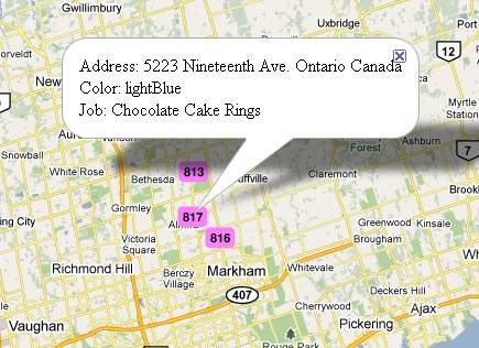
Some of our customers use MaxScheduler for delivery planning. We recently added a feature to plot delivery addresses onto a map. This is useful when trying to plan delivery routes.
The option works if you have an attribute called 'Addresses'. Enter addresses that are specific enough to narrow down the destination point. The address mapping may fail if there is to little address info, for example just a street name. Also it may fail if there is conflicting address information. For example naming a street in New York, but including a California postal code. A good way to check feasible addresses is to check through Google Maps . Some examples of suitable address forms are:
i) Postal code and Country
ii) Street address, City, State and Country
iii) Major city and Country
Start the mapping process through menu Board | Create Delivery Map. The software will bring up a transript screen and start mapping the addresses. It takes a couple of seconds for each address. When completed a summary report is shown saying how many good and bad addresses were processed. A map will be displayed of the address points. Each point is labeled with the 'id' column that is present in the List view. You can click on a marker and the details for that delivery will show up in a pop-up window.
